
 |
Home | Makalu Main | References | Contact |
Last Updated: January 2010. Click on an image to see the FULL size with a caption.
The times shown are the actual trekking times including photo stops, but not including rest or lunch stops. The altitudes are mainly from Lonely Planet.
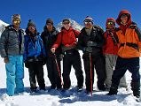
My crew at the West Col:
Climbing Sherpa Palde (his fourth time with me), Cook Pemba Rinjii - fifth time, porter Pal Dorje - second time, Jerome Ryan, Guide Gyan Tamang - eighth time, porter Tenzing - second time, and cook's helper Pasang - second time.
The routine is almost the same each day. I get up around 5:30; bed milk-tea is at 6:00 followed by washing water at 6:15 and breakfast at 6:30. We are on the trail around 7:00, reaching our lunch spot after three to four hours. The afternoon trek is shorter, around two to three hours. I then read a book and have afternoon milk-tea and cookies. Soup and a snack like papadam or popcorn is served around 18:00, followed by dinner. When the crew starts to eat their dinner, usually dhal bhat, I head for bed around 19:00.
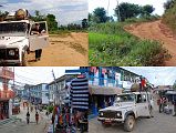
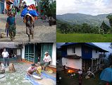
After meeting my guide Gyan at the Kathmandu Tribhuvan International Airport, we took a taxi for a minute to the chaotic Kathmandu domestic airport. Gyan’s luggage was overweight, so he arranged for a young woman fellow passenger to join our group temporarily. In return for her carrying some of our luggage, we agreed she could ride in our jeep from Tumlingtar.
The flight finally left Kathmandu about two hours late, passing the terraced Nepalese hills on the way to Tumlingtar. The flight from Kathmandu took just 40 minutes to land on the grass strip at Tumlingtar (355m), located on a shelf above the Arun River. I met the rest of our crew: Palde climbing Sherpa, Pemba Rinji cook, Pasang cook’s helper Tenzing porter, and Pal Dorje porter. We waited for our luggage to be wheeled across the field and had a quick lunch.
We jumped into the jeep Palde had arranged to start our drive to Mane Bhanjyang (cost was $65 in 2009). The rough jeep road from Tumlingtar climbs in one hour to Khandbari (1040m), a busy bazaar town with flagstoned pavements and three-storied, stone-built, shop-houses, From Khandbari the jeep road continues with a few ups and down taking only 30 minutes to the village of Mane Bhanjyang (1100m). Supposedly the road was too rough to continue any further, although we did see more jeeps on the road the next day.
We hiked for 40 minutes from Mane Bhanjyang (1100m) with views towards Botebas through bamboo forests to Arun Than (1280m), where we stopped briefly to buy some fresh rice. It took only another 20 minutes to traverse across the hillside, still climbing through fields, bamboo groves and big rocks to Sheka (1350m), where we camped next to a house just below the local school.
The temperature in Kathmandu was 28C, Tumlingtar 35C, and at our camp in Sheka 22C. The overnight temperature was 20C with some light rain.
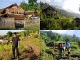
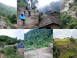
I walked above our camp in Sheka (1350m) to watch the sunrise over a Hindu Shrine. While I waited for breakfast, I walked around the house where we camped, watching the chickens and sheep have their breakfast too. I again walked above the house in Sheka and visited the Hindu shrine to Saraswati and the local school.
After breakfast, we started our trek from Sheka in sunny weather, passing the local houses with their terraced fields. The sun quickly disappeared as the fog rolled in, and it took just one hour to trek from Sheka to Bhotebas (1740m) with a stone chorten and Buddhist rock paintings. From Bhotebas we shared the easy flat trail with jeeps and donkeys, taking just one hour to walk to Chichilla.
We stopped at the small ridge-top village of Chichilla (1830m) to have lunch. I walked around the village admiring the beautiful wild orchids lining the side of the road, and a scale to weight merchandise.
The trail from Chichilla reaches the end of the jeep road in 40 minutes, and then arrives in Sakurate (1895m) in another 10 minutes. The trail passes a few tea shops at Fururu (1965m), and then climbs again along the ridge line to the high point of Deorali in 40 minutes. The trail descends slightly to pass through the very small village of Mure (2000m), 35 minutes from Deorali, and then descends on a rocky eroded trail to the terraced fields of Num (1500m), 70 minutes from Mure.
We met three teenage school girls on the trail returning from the Khandbari market to Num, walking with them much of the way. One of the school girls invited us to camp at her house in Num, which we gladly accepted. Num is a small village with a primary school situated on a ridge above an S-shaped bend in the Arun Kosi. Two sisters, one in grade 9 and the one in grade 10 who invited us to camp at her house, get ready for school in Num. From the house in Num where we camped, we could see Sedua and Manigaon directly across the valley, but sadly 900m down and then up again.
The temperature during the day was a relatively cool 22C in the cloudy weather. The overnight temperature was 18C with some rain.
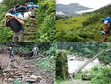
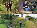
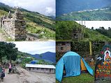
The trail was exceptionally steep off the south side of the Num ridge, dropping on slippery rocks through jungle to a suspension bridge over the torrential Arun Kosi (630m), arriving after 70 minutes just dripping with sweat. After a brief rest, we crossed the bridge over the Arun Kosi (630m) and began the long hard climb to Sedua.
From the Arun River Bridge (630m) the trail climbs steeply to a primitive tea shop where I had a Pepsi and some bananas to try and combat my dehydration. The trail then goes through rice, corn and buck wheat fields on the long, steep, rough climb to Sedua (1460m), taking 2:20 in walking time from the bridge. We registered with the Barun national park office next to the camping ground, and then had lunch.
The trail climbs the ridge above Sedua (1460m) and then climbs gently northwards through rice fields to Manigaon (1780m) on the next ridge, with splendid views back to Num across the valley. From Manigaon the trail turns west and makes a gradual climb high above the Kasuwa Khola to a mani wall at Chyksadanda (1890m), just 75 minutes from Sedua. Once again we camped at one of the local houses, with a small rock painting of Buddha next to my tent.
The temperature near the Arun River was 27C, while the afternoon temperature higher up was 20C. The overnight temperature was 18C with lots of rain.
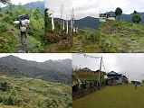
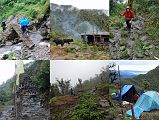
The trail from Chyksadanda was wet and slippery from the overnight rain, and went through terraced fields and forested areas, passing the villages of Hindrungma and Ropesa, to reach the stone staircase connecting the bottom of Tashigaon (2070m) with the top of Tashigaon (2160m). It took just 75 minutes to trek from Chyksadanda to Tashigaon, the last settlement in the valley where we had an early lunch next to the campground.
The trail goes north From Tashigaon, crossing a few streams in a lush cloud forest, and then onto a ridge where there is a small herder’s hut. The trail levels out, and then climbs to another shepherd’s hut atop another ridge. The route now becomes steeper, switch backing on rain-soaked slippery rocks up the ridge in forests to a kharka. A stone chorten and prayer flags mark the gateway into the Makalu-Barun National Park area at the top of the ridge (3190m). The trail descends in more open country on the west side of the ridge to Unshisha (3180m), a tiny soggy meadow, where Palde, Pemba Rinjii and Pasang cleared spots for the kitchen tent and my tent. It took 3:10 to trek from Tashigaon to Unshisha.
The temperature was only about 20C during the cloudy rainy day, while the overnight temperature was 8C with heavy rain. My tent leaked, and I had to keep moving to avoid the puddles,
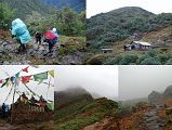
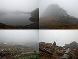
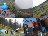
The trail from Unshisa (3180m) gets even steeper and becomes a series of rough stone stairs ascending to the top of the ridge and then descends a bit to the few buildings and campsite of Kongma (3560m) in 50 minutes from Unshisha, The trail from Kongma twists and turns steeply, passing through forest before emerging in just 35 minutes at the Kongma La (3850m) where there is a stone chorten adorned with prayer flags. The trail follows the ridge through rhododendrons for a while, and then ascends a stone staircase. After a few false summits the trail climbs over the first of three passes (4055m) in just 40 minutes from Kongma La.
The trail descends from the first pass to the Thulo Pokhari (3990m, big pond), and then climbs steeply up a shallow rocky gully to the prayer flags and stone chorten at Shipton La (4216m), in 60 minutes from the first pass. The Shipton La was named after Eric Shipton who, with Edmund Hillary, used this route to trek out from their 1952 Everest reconnaissance. The trail descends from the Shipton La in just 15 minutes to two lakes (4030m), with a few buildings where we ate our lunch. The trail then ascends through large boulders for another 20 minutes to the third pass at 4145m.
On the other side of the three passes the route enters a valley filled with rhododendron forests, and descends often in the middle of a stream to a few buildings in a meadow below the pass called Dobato, taking 50 minutes from the third pass. The route traverses through huge rhododendrons, finally making a steep descent through a pine forest to the Mumbuk (3500m) camp site in another 45 minutes. Mumbuk is a small clearing place for camping in the middle of the woods of pines, hemlock, birch and rhododendrons.
The temperature during this rainy cloudy foggy day was only about 7C, while the overnight temperature was 5C with no rain.
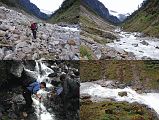
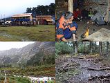
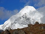
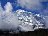
It was clear in the morning at Mumbuk with views through the trees to the mountains. From Mumbuk, the trail descends in just 35 minutes 300m down a steep, rocky gully to the Barun Khola at the bottom of the Barun Valley, with a good view of Peak 7 (6105m) up the valley.
The trail traverses up and down alongside the Barun Khola until it reaches an open landslide area in another 35 minutes. It took 40 minutes to cross this long landslide area just above the Barun Khola, with lots of boulder hopping and streams to jump across. Beyond the landslides, the valley widens and the forest gives way to rolling alpine meadows, taking another 95 minutes to the bridge over the Barun Khola and on to Yangle Kharka.
Yangle Kharka (3600m) is a large meadow with some teahouses, where we had lunch. The Barun River valley becomes increasingly steep from Yangle Kharka, with waterfalls gushing down sheer rock faces on the sides of the river. The climb starts out gently from Yangle Kharka, and after just 35 minutes passes Nehe Kharka (3750m), a large, open, grassy plain on the opposite side of the Barun Khola. Beyond Nehe Kharka, the trail climbs above the river through a forest as the river makes a huge S-shaped curve and the walls rise almost vertically 1500 to 2000m above the river. The trail reaches a single house at Riphuk Kharka (3930m), and then climbs again to Jark Kharka (4210m), arriving after 1:50 from Nehe Kharka.
The temperature during this initially sunny but soon cloudy and rainy day was 8C, while the overnight temperature was 0C.
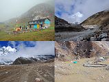
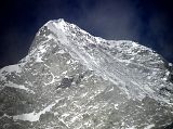
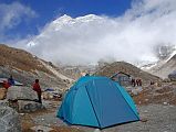
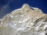
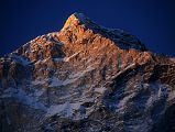
Chamlang East (7235m) shone in the early morning sun from just beyond Jark Kharka. The East Face of Peak 6 / Mount Tutse (6758m) was visible from just beyond Jark Kharka.
The trail from Jark Kharka (4210m) takes only 25 minutes to climb to the meadows of Langmale Kharka (4405m, also called Yak Kharka) where there is a hotel and shop. Beyond Langmale Kharka the trail climbs over a ridge and ascends alongside a moraine to Merek (4570m) a few sandy campsites above the river, taking 40 minutes from Langmale Kharka. Just after Merek, the valley turns west with views to Chamlang East and then slightly north to Sherson (4660m) on a grassy plain, taking another 55 minutes.
As I waited for my lunch at Sherson, I climbed a small ridge to see if any mountains would peak out from the clouds. I laid back enjoying the simplicity of just watching the clouds move, shape, and disperse. The view of Peak 6 / Mount Tutse (6758m) from Sherson shows the width of the mountain. Chamlang East (7235m) separated itself from an intervening ridge, when seen from Sherson. The first ascent of Chamlang East (7235m) and Central summits (7317m) was made in 1984 in alpine style by Doug Scott, Michael Scott, Ang Phurba and Jean Afanassieff via the East Ridge with the first descent of the Chamlang North Face. The summit ridge of Peak 4 (6736m), opened for climbing in 2003, came out of the clouds for a brief second. The clouds occasionally dissipated long enough to get a full view of the Makalu Southwest and South Faces from a ridge above Sherson..
After eating lunch at Sherson, the trail climbs gradually to a minor pass and then contours around a ridge before Makalu base Camp South comes into view. I was fascinated by an indentation on the Makalu Southwest face that looks surprisingly like a stick figure woman and a large long-haired man The trail descends about 100m and crosses a bridge over the Barun Khola to Makalu Base Camp South (4850m) on the west side of the river, just 55 minutes from Sherson. I paused at the monument to Jean-Christophe Lafaille to pay my respects.
Makalu Base Camp South (4850m) is a rocky barren place with a few buildings and shops with Makalu Southwest Face looming overhead and the Barun Pokhari and large Barun Glacier beyond. I enjoyed the terrific views of the Makalu Southwest and South Faces from Makalu Base Camp South, especially at sunset.
Peak 3 / Sherson (6422m), a continuation of the Makalu Southeast Ridge, came out of the clouds at sunset The first ascent of Peak 3 / Sherson was made by Doug Scott, Jean Afanassieff, Larry Bruce, James Fullalove, Molly Higgins on April 23, 1984.
The temperature during the day was 8C, while the overnight temperature was -1C with some snow.
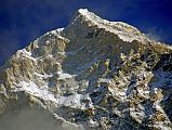
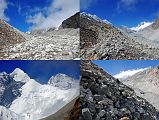
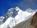
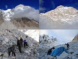
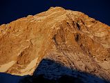
I woke at Makalu Base Camp South to a small layer of snow on the ground. Makalu once again played peak-a-boo through the clouds in the morning, with the sun shining on the South Face while the Southwest Face remained in shadow. I walked a few minutes from Base Camp South to view the Barun Pokhari beneath Makalu.
We didn’t leave Makalu Base Camp South until after 11:00 since it was going to be short trek. As I waited, the sun continued its western swing and slowly lit up the Makalu Southwest Face highlighting the ridges much better than the evening light.
The trail from Makalu Base Camp South (4850m) passes the Barun Pokhari before turning northwest and climbing an ablation valley on the west side of the Barun Glacier. The view of mountains to the northwest got better and better as I continued trekking, first with Lhotse, Lhotse Shar, Peak 38 and Cho Polu becoming visible, then Nuptse, then the Everest Kangshung East Face, and finally Baruntse.
The Makalu Southwest Face and West Pillar gave way to the Makalu West Face as I continued trekking on the enormous boulders above the Barun Glacier towards Makalu Sandy Camp After 2:30 we reached the Japanese Sandy Campsite (5300m), but there was already a large tour group camped there, so we climbed another 50m and Palde made a campsite for us.
The Makalu West Face, Makalu West Pillar, and Makalu Southwest Face towered directly overhead from Makalu Japanese Sandy Camp (5300m), with sunset being especially beautiful.
The temperature during the mostly cloudy day was 7C, while the overnight temperature was -7C.
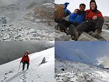
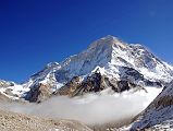
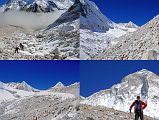
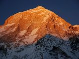
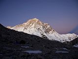
Although the local people call all of them the Sherpani Col, there are in fact three routes across the col – the Sherpani Col itself and two others of almost exactly the same height at the head of the next hanging valley. We took the East Col (6100m),
The trail from Makalu Sandy Camp (5300m) continues traversing the rocky and snowy ridge high above the Barun Glacier, before descending on snow as the trail turns to the west. Nuptse, Lhotse, Lhotse Shar, Everest Kangshung East Face, Peak 38 and Shartse were visible at the head of the Barun Valley. Makalu Base Camp North, Kangchungtse Makalu II, the route to the Makalu La, and Makalu West Face, Makalu West Pillar, and Makalu Southwest Face were visible behind.
The trail turns to the west from the Barun Valley and ascends steeply on enormous rocky boulders to a camp at around 5800m at the snout of the glacier leading to the East Col pass.
We arrived in the late morning, had lunch and then lazed around in the afternoon sun. A Sherpa descending from the East Col stopped at our camp for some tea and food, and mentioned that we could use the fixed rope that he had already put down the West Col. In the afternoon, Pemba Rinjii and Pasang carried some of our heavy items to the bottom of the East Col, so we could be faster for our long day tomorrow. The view of the Makalu West Face, Makalu West Pillar, and Makalu Southwest Face was excellent, especially at sunset.
The temperature during the day was 10C, while the overnight temperature was -8C.
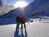
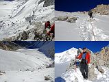
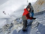
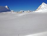
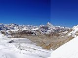
Although we were on the move an hour before sunrise at 5am, the other tour group had already left camp even earlier. I quickly fell into my trekking rhythm climbing on the glacier, walking slowly but continuously, counting my steps, and passed the trekkers from the other group. It took me 1:45 to arrive at the base of the East Col. It took another 25 minutes to climb the steep and rocky trail from the base of the East Col to the East Col, using a fixed rope for extra safety.
I turned around on the East Col (6135m) to admire Makalu West Face, Makalu West Pillar, Makalu Southwest Face and the route from the East Col Glacier Camp. From the top of the East Col, the stunning cirque included the long north ridge stretching from Chamlang East towards the west and Hongu Chuli ((also spelled Chonku) / Pyramid Peak (6833m), P6770 and the vast glacier leading to the West Col to the west, P6730 (sometimes called Little Baruntse) to the north.
After arriving at the East Col, the leader of the other tour group and Palde each fixed separate ropes to the bottom of the East Col on the west side. Pemba Rinjii and Pasang scooted to the bottom of the East Col in a few minutes. Palde and Gyan then lowered the loads and backpacks one at a time to the bottom of the East Col. The strap on Palde’s backpack broke when it was being let down, and it fell near a crevasse. Luckily, they were able to retrieve it later. Finally it was my turn to grab the fixed rope and descend the 125m 40-45 degree snow and rock face. Palde and Pemba Rinjii cut steps for me to make it easier and safer. The only real danger was falling rocks and ice kicked loose by the other group’s porters descending at the same time.
It took two hours for our group to descend the East Col, but the other group took much longer because they had more loads and porters. After a brief 15 minute rest, it took us only 50 minutes to cross the 3 km wide Lower Barun Glacier from the base of the East Col to the 6135m West Col.
We stopped for a team photo just before the West Col, with the Lower Barun Glacier, the East Col, and the Makalu West Face, West Pillar, and Southwest Faces behind. From left to right: climbing Sherpa Palde, cook Pemba Rinjii, porter Pal Dorje, Jerome Ryan, guide Gyan Tamang, porter Tenzing, and cook helper Pasang.
There is a very short climb from the glacier to the top of the West Col (6143m) with P6770 to the left. From the top of the West Col (6135m), the view from southwest to north included P6770, Peak 41 / Kyashar, Hongu Peak, Malanphulan, Kangtega, Khatang and Numbur, Tengkangpoche, Panalotapa, Tengi Ragi Tau, Mingbo La and Ombigaichen and Ama Dablam, Gauri Shankar, Drangnag Ri, Menlungtse. Taweche. The Amphu Labtsa (Lapcha) Pass (5780m) to the Chukung Valley is to the left of the long ridge descending from Baruntse. Baruntse Base Camp is next to the lake in the centre.
Once again, Palde and Gyan lowered the loads and backpacks down one at a time from the West Col (6143m) to the bottom. Finally it was my turn, but because this 200m descent down the 50-55 degree snow and rock face of the West Col is steeper and more dangerous than the East Col, I put on a harness and clipped into the fixed rope. Palde and Pemba Rinjii cut steps for me to make it easier and safer. The only real danger once again was falling rocks and ice kicked loose by the other group’s porters descending at the same time. It took 1:50 for our group to descend the West Col, but the other group arrived later and took much longer because they had more loads and porters.
Baruntse (7129m), one of the easiest 7000m peaks, finally stood out from the surrounding peaks as we descended from the West Col towards Baruntse Base Camp, The first ascent of Baruntse (7129m) was done on May 30, 1954 by Colin Todd and Geoff Harrow of the Hillary New Zealand Expedition via the Southeast Ridge.
From the bottom of the West Col, it was all downhill, first on the glacier, then on muddy rocks towards Baruntse Base Camp (5450m) next to a lake, with Hongu Peak, the eastern end Of Malanphulan, Ombigaichen and Ama Dablam beyond. It took just 85 minutes to descend from the bottom of the West Col to Baruntse Base Camp (5450m). P6770 on the ridge to the southwest from the West Col shines in the afternoon sun with my tent at Baruntse Base Camp in the foreground.
The temperature during the day was a sunny pleasant 0C, while the overnight temperature was -11C.