Mountains Of Travel Photos
Home | Makalu Main | Makalu References | Contact 

Makalu Photo Gallery - Trek Over East Col And West Col with views of Makalu, Chamlang, Hongu Chuli, P6770, Baruntse, Ama Dablam, Gauri Shankar, Menlungtse

Makalu Photo Gallery from October 2009 with views of Little Baruntse, Peak 41 / Kyashar, Hongu Peak, Malanphulan, Kangtega, Khatang and Numbur, Tengkangpoche, Panalotapa, Tengi Ragi Tau, Mingbo La and Ombigaichen, Drangnag Ri, and Taweche.
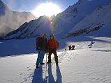
10 1 First Rays Of Morning Sun Hit Climbing Sherpa Palde and Jerome Ryan Trekking On Glacier Towards East Col Although we were on the move an hour before sunrise at 5am, the other tour group had already left camp even earlier. I quickly fell into my trekking rhythm climbing on the glacier, walking slowly but continuously, counting my steps, and passed the trekkers from the other group. Climbing Sherpa Palde and Jerome Ryan pause to enjoy the warmth of the first rays of the sun.

10 1 First Rays Of Morning Sun Hit Climbing Sherpa Palde and Jerome Ryan Trekking On Glacier Towards East Col

10 2 Climbing Sherpa Palde and Jerome Ryan Trekking On Glacier With East Col Beyond Climbing Sherpa Palde and Jerome Ryan pause to enjoy the warmth of the first rays of the sun with the route to the East Col ahead.

10 2 Climbing Sherpa Palde and Jerome Ryan Trekking On Glacier With East Col Beyond

10 3 Route To Top Of East Col From Makalu Side It took me 1:45 from the East Col Glacier Camp to trek to the base of the East Col.

10 3 Route To Top Of East Col From Makalu Side

10 4 Climbing To The East Col, Jerome Ryan On Top Of East Col It took another 25 minutes to climb the steep and rocky trail from the base of the East Col to the East Col (6135m), using a fixed rope for extra safety.

10 4 Climbing To The East Col, Jerome Ryan On Top Of East Col

10 5 Makalu West Face, West Pillar, Southwest Face And Glacier Trail From Top Of East Col I turned around on the East Col (6135m) to admire Makalu West Face, Makalu West Pillar, Makalu Southwest Face and the route from the East Col Glacier Camp.

10 5 Makalu West Face, West Pillar, Southwest Face And Glacier Trail From Top Of East Col

10 6 Chamlang North Face, Chongku Hongu Chuli From East Col From the top of the East Col (6135m), the stunning cirque included the long north ridge stretching from Chamlang East towards the west. The triangular peak in the middle right foreground is Hongu Chuli (also spelled Chonku Chuli) / Pyramid Peak (6833m).

10 6 Chamlang North Face, Chongku Hongu Chuli From East Col

10 7 Chamlang North Face, P6770, And Glacier To West Col From East Col From the top of the East Col (6135m), the long North ridge of Chamlang gives way to P6770, and the glacier leading to the West Col (6143m) with views of mountains beyond including Peak 41, Peak 43 Kyashar, and Malanphulan.

10 7 Chamlang North Face, P6770, And Glacier To West Col From East Col

10 8 Glacier To West Col, Little Baruntse From East Col As I turned towards the right / north from the top of the East Col (6135m), P6730 (sometimes called Little Baruntse) blocked the view to Baruntse.

10 8 Glacier To West Col, Little Baruntse From East Col

10 9 Lowering Loads From Top Of East Col After arriving at the East Col, the leader of the other tour group and Palde each fixed separate ropes to the bottom of the East Col on the west side. Pemba Rinjii and Pasang scooted to the bottom of the East Col in a few minutes. Palde and Gyan then lowered the loads and backpacks one at a time to the bottom of the East Col. The strap on Palde’s backpack broke when it was being let down, and it fell near a crevasse. Luckily, they were able to retrieve it later.

10 9 Lowering Loads From Top Of East Col

10 10 Jerome Ryan Climbing Down East Col Finally it was my turn to grab the fixed rope and descend the 125m 40-45 degree snow and rock face. Palde and Pemba Rinjii cut steps for me to make it easier and safer. The only real danger was falling rocks and ice kicked loose by the other group’s porters descending at the same time.

10 10 Jerome Ryan Climbing Down East Col

10 11 Route To Bottom Of East Col From West Col Side I looked back at the descent route from the East Col (6135m) on the West Col side. It took two hours for our group to descend the East Col, but the other group took much longer because they had more loads and porters.

10 11 Route To Bottom Of East Col From West Col Side

10 12 Glacier To West Col From East Col After a brief 15 minute rest, it took us only 50 minutes to cross the 3 km wide Lower Barun Glacier from the base of the East Col to the 6135m West Col.

10 12 Glacier To West Col From East Col

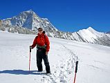
10 13 Jerome Ryan With Makalu West Face, West Pillar, Southwest Face And East Col From Glacier To West Col Jerome Ryan with Makalu West Face, Makalu West Pillar, Makalu Southwest Face and the route from the East Col to the West Col behind.

10 13 Jerome Ryan With Makalu West Face, West Pillar, Southwest Face And East Col From Glacier To West Col

10 14 Makalu West Face, West Pillar, Southwest Face And East Col From Glacier To West Col Makalu West Face, Makalu West Pillar, and Makalu Southwest Face close up from the West Col (6143m). The East Col is at the lower right of centre of the photo to the left of the snow.

10 14 Makalu West Face, West Pillar, Southwest Face And East Col From Glacier To West Col

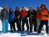
10 15 Climbing Sherpa Palde, Pemba Rinjii, Pal Dorje, Jerome Ryan, Guide Gyan Tamang, Tenzing, Pasang On Glacier To West Col With Makalu Behind We stopped for a team photo just before the West Col - from left to right: climbing Sherpa Palde, cook Pemba Rinjii, porter Pal Dorje, Jerome Ryan, guide Gyan Tamang, porter Tenzing, and cook helper Pasang.

10 15 Climbing Sherpa Palde, Pemba Rinjii, Pal Dorje, Jerome Ryan, Guide Gyan Tamang, Tenzing, Pasang On Glacier To West Col With Makalu Behind

10 16 West Col And P6770 From Glacier Just Before West Col There is a very short climb from the glacier to the top of the West Col (6243m) with P6770 to the left and Peak 41, Hongu Peak, and Peak 43 Kyashar ahead.

10 16 West Col And P6770 From Glacier Just Before West Col

10 17 Peak 41, Hongu Peak, Peak 43 Kyashar, Malanphulan, Kangtega, Ombigaichen, Ama Dablam, Gauri Shankar, Menlungtse, Taweche From West Col From the top of the West Col (6135m), the view from southwest to north included P6770, Peak 41, Hongu Peak, Peak 43 Kyashar, Malanphulan, Kangtega, Khatang and Numbur, Tengkangpoche, Panalotapa, Bigphera Go Shar, Mingbo La, Tengi Ragi Tau, Ombigaichen and Ama Dablam, Gauri Shankar, Drangnag Ri, Menlungtse, and Taweche. The Amphu Labtsa (Lapcha) Pass (5780m) to the Chukung Valley is to the left of the long ridge descending from Baruntse. Baruntse Base Camp is next to the lake in the centre.

10 17 Peak 41, Hongu Peak, Peak 43 Kyashar, Malanphulan, Kangtega, Ombigaichen, Ama Dablam, Gauri Shankar, Menlungtse, Taweche From West Col

10 18 Hongu Peak, Peak 43 Kyashar, Malanphulan, Kangtega, And Khatang From West Col From the top of the West Col (6135m), the view to the west included Hongu Peak below and Peak 43 Kyashar above, Malanphulan to the right of centre with Kangtega above it, and Khatang to the far right.

10 18 Hongu Peak, Peak 43 Kyashar, Malanphulan, Kangtega, And Khatang From West Col

10 19 Mingbo La, Ombigaichen, Ama Dablam, Gauri Shankar, Drangnag Ri From West Col From the top of the West Col (6135m), the view to the west included Mingbo La at the far left, Tengi Ragi Tau in the distance, the pointy summit of Ombigaichen, Ama Dablam, and Gauri Shankar and Drangnag Ri in the distance to the right.

10 19 Mingbo La, Ombigaichen, Ama Dablam, Gauri Shankar, Drangnag Ri From West Col

10 20 Gauri Shankar, Drangnag Ri, Menlungtse, Taweche From West Col From the top of the West Col (6135m), the view to the northwest included the east face of Gauri Shankar, the triangular summit of Drangnag Ri, the saddle connecting the Menlungtse West and East summits, and Taweche to the right.

10 20 Gauri Shankar, Drangnag Ri, Menlungtse, Taweche From West Col

10 21 Looking Down At Descent Route From Top Of West Col Once again, Palde and Gyan lowered the loads and backpacks down one at a time from the West Col (6143m) to the bottom.

10 21 Looking Down At Descent Route From Top Of West Col

10 22 Looking Up At West Col And Descent Route From Half Way Down Finally it was my turn, but because this 200m descent down the 50-55 degree snow and rock face of the West Col is steeper and more dangerous than the East Col, I put on a harness and clipped into the fixed rope. Palde and Pemba Rinjii cut steps for me to make it easier and safer. The only real danger once again was falling rocks and ice kicked loose by the other group’s porters descending at the same time.

10 22 Looking Up At West Col And Descent Route From Half Way Down

10 23 Full View Of Descent Route To Bottom Of West Col It took 1:50 for our group to descend the West Col, but the other group arrived later and took much longer because they had more loads and porters. Here is a view of the full descent route from the West Col.

10 23 Full View Of Descent Route To Bottom Of West Col

10 24 Baruntse From Below West Col Baruntse (7129m), one of the easiest 7000m peaks, finally stood out from the surrounding peaks as we descended from the West Col towards Baruntse Base Camp, The first ascent of Baruntse (7129m) was done on May 30, 1954 by Colin Todd and Geoff Harrow of the Hillary New Zealand Expedition via the Southeast Ridge.

10 24 Baruntse From Below West Col

10 25 Baruntse Base Camp Beyond Lake With Hongu Peak, Eastern End Of Malanphulan, Ama Dablam From the bottom of the West Col, it was all downhill, first on the glacier, then on muddy rocks towards Baruntse Base Camp (5450m) next to a lake, with Hongu Peak on the far left, the eastern end of Malanphulan in the centre, and Ombigaichen and Ama Dablam to the far right.

10 25 Baruntse Base Camp Beyond Lake With Hongu Peak, Eastern End Of Malanphulan, Ama Dablam

10 26 Baruntse Base Camp With P6770 Behind It took just 85 minutes to descend from the bottom of the West Col to Baruntse Base Camp (5450m). The West Col is on the far left with P6770 in the centre shining in the afternoon sun with my tent at Baruntse Base Camp in the foreground.

10 26 Baruntse Base Camp With P6770 Behind