Mount Everest 8848m
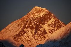
Everest North and Southwest Faces Close Up From Gokyo Ri At Sunset
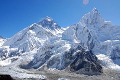
Mount Everest, Lhotse, Nuptse From Kala Pattar
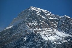
Mount Everest Close Up From Kala Pattar
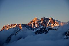
Nuptse, Everest, Lhotse South Face, Lhotse, Lhotse Middle, Lhotse Shar From Mera High Camp At Sunset
Mount Everest (8848m, 29029ft) is the highest mountain in the world. The summit ridge of the mountain marks the border between Nepal and Tibet.
Height: The official height of Mount Everest was calculated to be 8848m (29,028 ft) in 1954. In 1999 the American Everest Expedition used GPS to recalculate the height to be 8850m. In 2005 the Chinese Everest Expedition Team used complicated measurement and calculation to measure the height of Everest to be 8844.43 m (29,017.07 ft). This new height is based on the actual highest point of rock and not on the snow and ice that sits on top of that rock on the summit. Mount Everest is still growing in height by a few centimetres each year as the India plate slides under the Asian plate.
Name: Peak XV of the Indian Survey was named Mount Everest by Sir Andrew Waugh, the British surveyor-general of India, who named it after his predecessor, Sir George Everest. In Nepal, the mountain is called Sagarmatha (Forehead of the Sky) and in Tibetan Chomolungma or Qomolangma (Mother of the Universe).
Lukla To Gokyo, Gorak Shep And Everest Base Camp
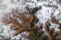
I trekked to the Everest Southwest Face in the Solu-Khumbu area of Nepal three times.
In 1997, I flew to Lukla and trekked to Namche Bazaar, Tengboche, Dingboche, Chukung, Lobuche, and Kala Pattar.
In 2000, I flew to Lukla and trekked to Gokyo, Tengboche, Dingboche, Lobuche, Gorak Shep, and Everest Base Camp.
In 2008, I trekked from the Rolwaling Valley over the Tashi Lapcha pass to Thame, over the Renjo La to Gokyo, over the Cho La to Gorak Shep and to Kala Pattar, over the Kongma La from Lobuche to Dingboche, and back to Lukla.
I had a wonderful view of Everest from my climb of Mera Peak East Summit in 2009.
I have also taken the mountain flight from Kathmandu several times, all with spectacular views of Everest.
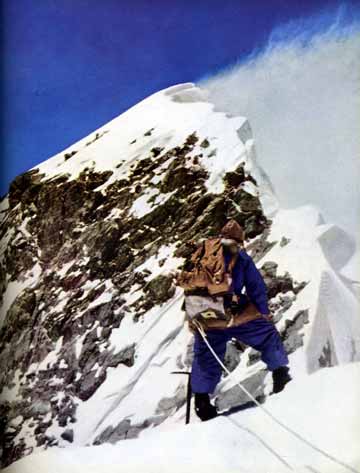
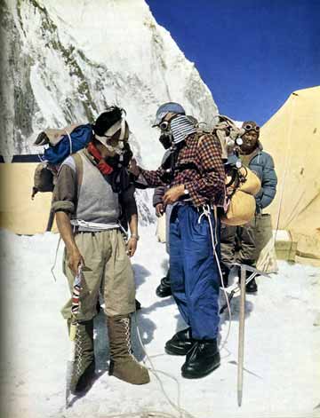
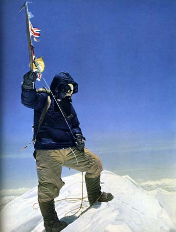
The first ascent of Mount Everest was completed by Edmund Hillary and Tenzing Norgay on May 29, 1953 at 11:30. John Hunt became the leader of the British Expedition to Mount Everest on Sept. 11 1952. The team members were deputy Charles Evans, Tom Bourdillon, Edmund Hillary, George Lowe, Charles Wylie, Michael Westmacott, George Band, Wilfrid Noyce, Tenzing Norgay, doctor Michael Ward, stills photographer Alfred Gregory. They fairly quickly solved the first challenge of the Khumbu icefall, and then into the Western Cwm to the foot of the Lhotse Face. The Lhotse Face was a far bigger challenge, taking 12 days before Wilfrid Noyce reached the South Col on May 21, 1953.
The first summit team of Charles Evans and Tom Bourdillon reached the South Summit on May 26, 1953. "Then quite suddenly the angle eased, and almost at once they found themselves standing upon the South summit of Everest, at about 28,700 feet. It was 1 o’clock. Charles Evans and Tom Bourdillon had climbed higher on Everest by many hundreds of feet than anyone had ever climbed before." It was too late in the day so they turned around and descended.
On May 28 the second assault team of Tenzing Norgay and Edmund Hillary reached Camp IX at 8500m. The next morning Tenzing and Hillary left their high camp at 6:30, reaching the South summit at 9:30. Edmund Hillary: "We looked with some interest at the virgin ridge ahead. ... After an hour’s steady going we reached the foot of the most formidable-looking problem on the ridge – a rock step some forty feet high. ... On its east side was another giant cornice, and running up the full forty feet of the step was a narrow crack between the cornice and rock." Hillary climbed what is now called the Hillary Step with Tenzing on belay, and then continued plodding towards the summit. "We shook hands and then Tenzing threw his arm around my shoulders and we thumped each other on the back until we were both almost breathless. It was 11:30 a.m." Hillary: “I had carried my camera, loaded with colour film, inside my shirt to keep it warm, so I now produced it and got Tenzing to pose for me on the top, waving his ice-axe on which was a string of flags—British, Nepalese, United Nations, and Indian. Then I turned my attention to the great stretch of country lying below us.”
North Face First Ascent
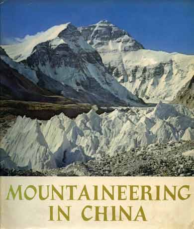


On May 25, 1960 the first successful ascent of the Everest North Face was made by a Chinese team consisting of Wang Fuzhou, Qu Yinhua and a Tibetan, Gingbu (Konbu) using the North Ridge. Climbing at night and running out of oxygen, "Wang Fu-chou resolutely declared, 'We'll press ahead!' 'Sure, we will!' responded Chiu Ying-hua and Gonpa in one voice. ... They wrapped a plaster bust of Chairman Mao Tse-tung in the five-star national flag of China, placed it in the crevice of a great rock to the northwest of the summit"
West Ridge First Ascent
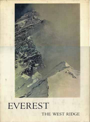
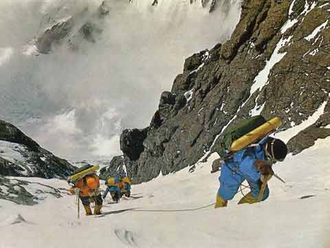
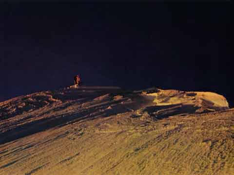
The 1963 Mount Everest Expedition had two major successes. First, Jim Whittaker became the first American to summit Everest on May 1, 1963, via the South Col. The second was a major feat of mountaineering, when Thomas Hornbein and Willi Unsoeld summitted Everest on May 23, 1963 by the extremely difficult West Ridge. Before summiting they had to move onto the North face, climbing what is now called the Hornbein Couloir. They then traversed the mountain and descended via the South Col route, having to bivouac near the summit without any food, supplemental oxygen, or shelter.
"What possible difference could climbing Everest make? …Was I greater for having stood on the highest place on earth? …It had been a wonderful dream, but now all that lingered was the memory. The dream was ended… The goal, unattainable, had been attained. Or had it?" - Thomas Hornbein.
Southwest Face First Ascent

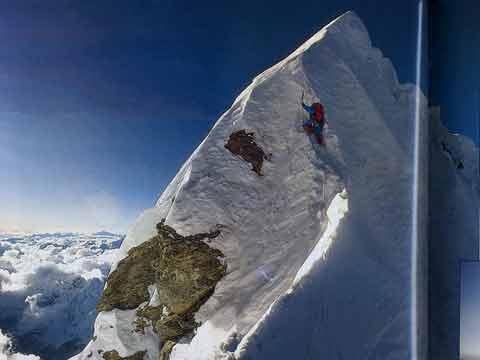
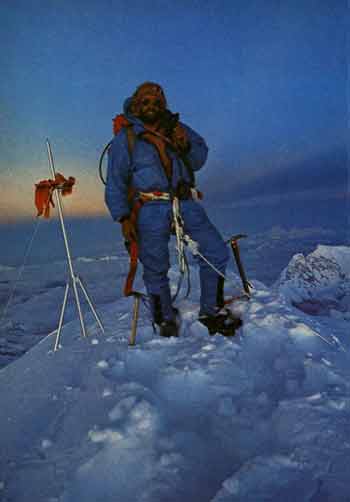
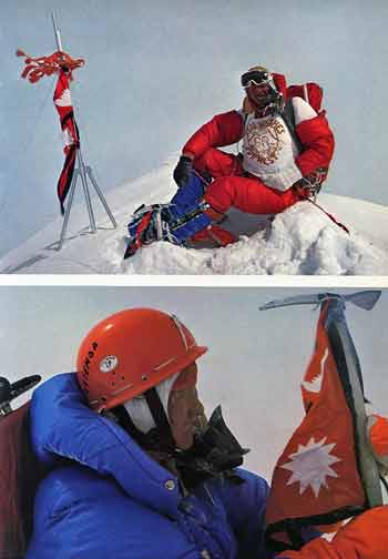
Chris Bonington led a large scale expedition with the combined effort of 40 Sherpas, 16 climbers. Although he didn't have a chance at the summit, Nick Estcourt was instrumental in solving the problem of the Rock Band and had led the most difficult pitch on the face.
On September 24, 1975 Doug Scott and Dougal Haston successfully made it to the summit. Doug: “All the world lay before us. The summit was everything and more that a summit should be. My usually reticent partner became expansive, his face broke out into a broad happy smile and we stood there hugging each other and thumping each other’s backs. … the view was so staggering, the disappearing sun so full of colour that the setting held us in awe." They descended to the South Summit and survived a bivouac in a snowcave.
On Sept. 26 Pete Boardman and Sirdar Pertemba reached the summit and descended in a gathering storm, where they encountered Mick Burke just below the summit. But tragedy struck - Burke wasn't seen again. Martin Boysen: “At first I could hardly accept Mick’s death; I clung to slender hope, but with each passing hour all hope disappeared, torn and blown away by the raging winds and blizzard."
First Ascent Without Oxygen
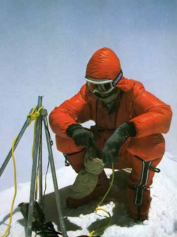
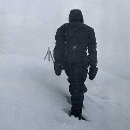
On May 8, 1978 Reinhold Messner and Peter Habeler completed the first ascent of Mount Everest without oxygen, via the normal Nepalese southeast route.
Messner: "I was no longer my normal perceptive self, rather a single, tight, coughing lung, floating above mists and summits. ... The instant Peter reached me and hugged me, we both burst into tears and lay there in the snow, wracked with emotion. ... Everything that is, that I am, was based on my knowledge that I had reached the top. The summit - at least temporarily - was my naive, intuitive answer to the question of existence."
First Solo Ascent
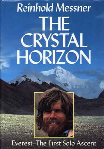
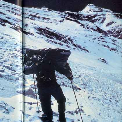
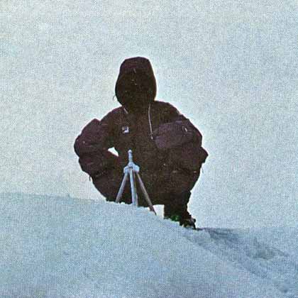
Just two years after breaking the oxygen barrier by climbing Everest from Nepal without the aid of oxygen in 1978, Messner ups the ante by climbing alone, without oxygen, and alpine style up the North Face of Everest in the summer months of 1980. He carried only a tent, camera, two ski sticks and an ice axe, and food. His base camp is just him and a female friend.
Messner fell into a crevasse before even starting the climb to the North Col. "I am falling into the depths and experience the fall in slow-motion, strike the walls of the widening crevasse once with my chest, once with my rucksack." Luckily he landed on a snow bridge and was able to climb out and continue the climb. He veered off the normal North Face route above the North Col and climbed the Norton Couloir. "I know of no mountain, no other region from which there is such an infinite view as from Mount Everest across the Tibetan plateau."
"During the ascent I am like a walking corpse. What holds me upright is the world around me: air, sky, earth, the clouds. ... No despair, no happiness, no anxiety. I have not lost the mastery of my feelings., there are actually no more feelings. ... Above me nothing but sky. I sense it." Reinhold Messner completed the first solo climb of Mount Everest when he reached the summit on August 20, 1980 at 3pm.
Messner's writing is interesting and poetic, letting us know his feelings and inner-most thoughts. The photos are very good and help illustrate the story, including photos from the 1920s and early Everest attempts, of Messner's trip from Lhasa to Base Camp, the climb and on the summit in a whiteout.
East Kangshung Face First Ascent

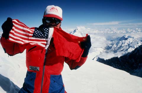
A 1981 American attempt led by Richard Blum and Louis Reichardt, including Edmund Hillary, George Lowe, John Roskelley, and Kim Momb made progress on the steep rock buttresses, but aborted at around 7000 meters due to high avalanche danger.
The first successful ascent of the Kangshung Face was made in 1983 by an American expedition led by James D. Morrissey. After five and a half weeks of effort, Kim Momb, Carlos Buhler, and Louis Reichardt summited on 8 October 1983. George Lowe, Dan Reid and Jay Cassell summited the next day.
North Face Direct
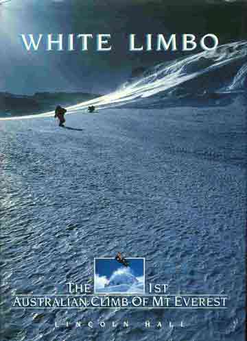
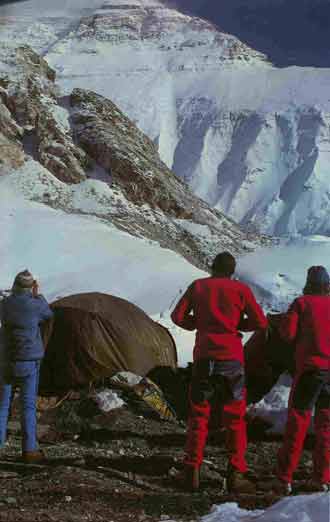
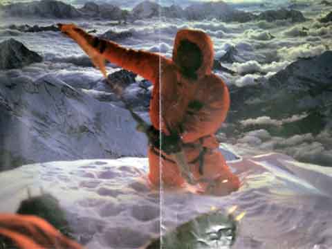
In 1984 five young Austrailians chose a new route up the North Face, climbing through the huge central snowfield, dubbed “White Limbo,” to gain the Great Norton Couloir. They climbed alpine-style without the aid of artificial oxygen.
"At 7:45 p.m. Tim and Greg reached the West Ridge. A couple of apparently insignificant rock bands had given more involved climbing than planned and that had slowed them down. But now the North Face had been climbed. The final snow slope to the summit took another half an hour. Just on sunset, shortly after eight o'clock, Greg and Tim stood on top of the world." Tim McCartney-Snape and Greg Mortimer became the first Australians to climb Everest when they stood on the summit at sunset on October 3, 1984. Tim: "Well, this is the summit of Mt Everest ... Qomolangma ... Mother Goddess of the Earth. It's the most beautiful sunset I've ever seen."
East Kangshung Face Second Ascent
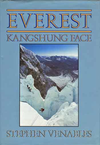
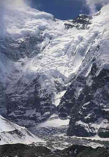
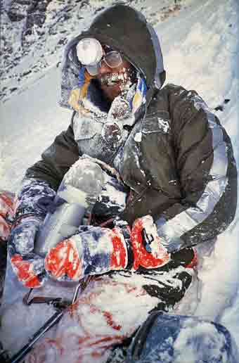
On May 12, 1988 Stephen Venables climbed a new route on the Everest Kangshung Face, up the South Buttress to reach the South Col, and then to the summit. It was only the second summit from the Kangshung East side.
Venables descent from the summit in a blizzard is as chilling and frightening as Maurice Herzog's Annapurna, with Stephen having to bivouac just below the summit. At one point in his descent, he sits in the snow and considers just staying there and dying.
1996 Disaster
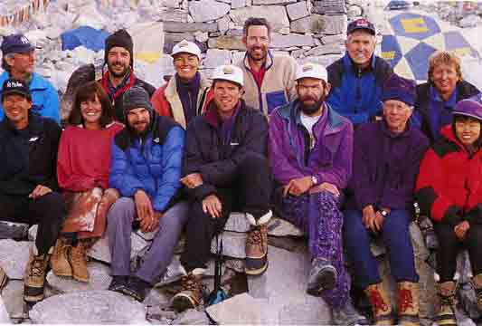
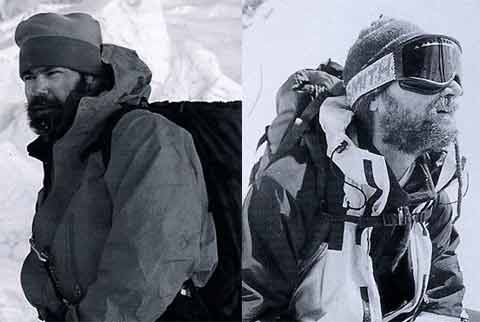
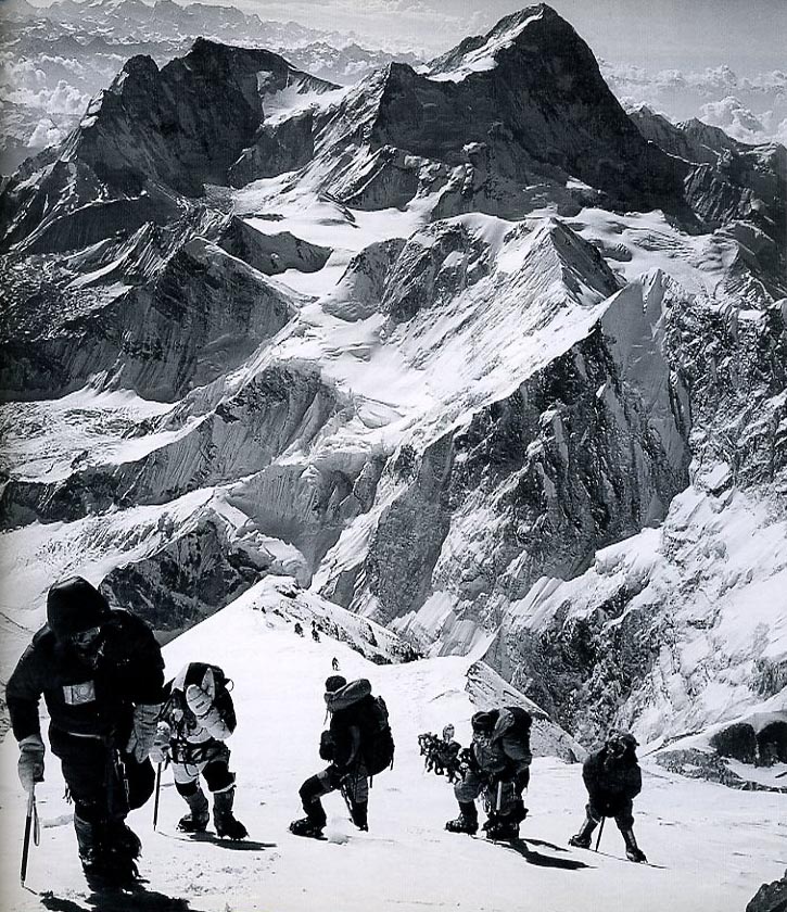
Jon Krakauer in his book Into Thin Air provides a day-by-day journal to tell the chilling, harrowing and controversial story about the 1996 Everest season when 12 climbers were killed.
"In March 1996, Outside magazine sent [Jon Krakauer] to participate in, and write about a guided ascent of Mount Everest", on Rob Hall's Adventure Consultants expedition. In addition to Hall's eight clients, Scott Fischer's Mountain Madness guided expedition also had eight clients. Scott Fischer: "We've got the big E figured out ... we've built a yellow brick road to the summit." Krakauer did reach the Everest summit on May 10, 1996 at 13:10. Worrying about his dwindling oxygen, he left the summit after just five minutes, finally making it back to his tent on the South Col at about 18:45, "more exhausted than I'd ever been in my life." "The storm abruptly metastasized into a full-blown hurricane, and the visibility dropped to less than twenty feet ... nineteen men and women were stranded up on the mountain by the storm, caught in a desperate struggle for their lives."
Two guides, two Sherpas, and seven clients had reached the South Col, but "staggered blindly around in the storm, growing ever more exhausted and hypothermic." In a small break in the storm, Camp Four was slightly visible. "Pittman, Fox, Weathers, and Namba were too feeble to walk", so Neil Beidleman, Klev Schoening, Lene Gammelgard, the two Sherpas, and Mike Groom stumbled off into the storm, making it back to the tents on May 11 at 00:45. Fisher's guide Anatoli Boukreev had descended to Camp Four in advance of his clients, and was the only strong climber left. Boukreev courageously single-handedly attempted to brave the storm to rescue the missing climbers, but had to return to the tents. But Boukreev didn't give up. He went out again by himself and was able to find the climbers, and brought back first Charlotte Fox and then Sandy Pittman and Tim Madsen. Yasuko Namba was dead and Beck was a lost cause.
Rob Hall waited for Doug Hansen to reach the summit at around 16:00, but Hansen turned into a "zombie" on the descent. Andy Harris picked up oxygen from the South Summit and walked back up towards Hall and Hansen. "at 4:43 on the morning of May 11 ... [Hall] had descended to the South Summit. And at that point neither Hansen nor Harris was with him." The continuing storm on May 11 stopped the Sherpa's rescue attempt. Rob's pregnant wife in New Zealand was patched through to speak to Rob late on May 11, " 'I love you. Sleep well, my sweetheart. Please don't worry too much.' These would be the last words anyone would her him speak."
Scott Fischer was not very strong on summit day, and reached the summit late at 15:40. Lopsang Jangbu Sherpa was able to help Fisher descend, but he collapsed just below the Balcony about 400m above the South Col. Anatoli Boukreev reached Fisher late on the evening of May 11. "Down suit is unzipped, pulled off his shoulder, one arm is outside clothing. There is nothing I can do. Scott is dead."
Amongst the tragedy, there was a ray of joy. Beck Weathers collapsed on the South Col late on May 10 and was left for dead. Miraculously he regained consciousness on May 11 and stumbled back to Camp Four at 16:35 with his "bare right hand, naked to the frigid wind and grotesquely frostbitten ... outstretched ... [looking like] a mummy in a low-budget horror film." Beck miraculously survived the night and the IMAX team with David Breashears and Ed Viesturs helped him descend to Camp Two the next day. Lt. Colonel Madan Khatri Chhetri rescued Beck from Camp Two in his helicopter on May 13.
